Transportation Master Plan - Related Renderings
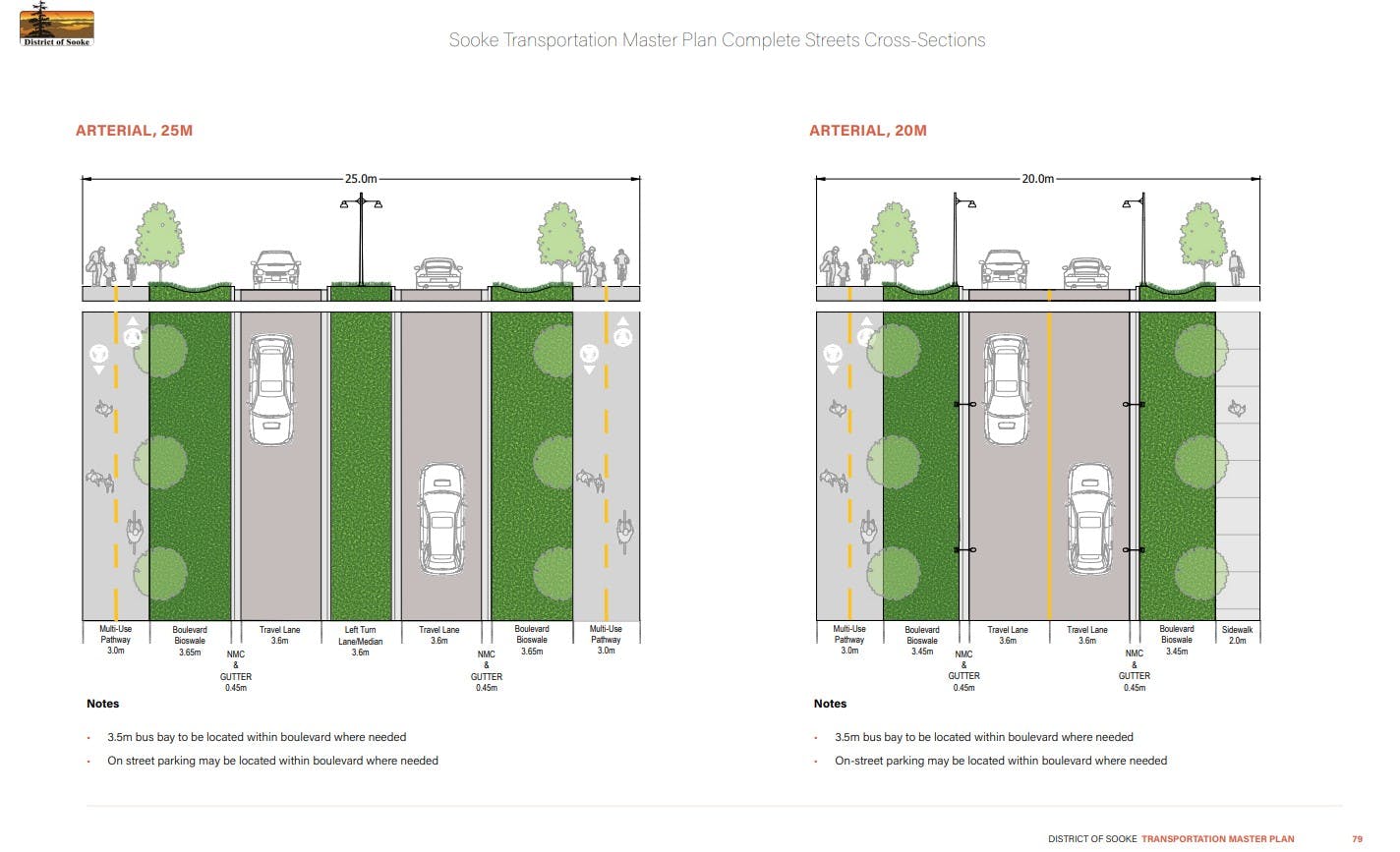
This diagram from the District of Sooke Transportation Master Plan illustrates two arterial road designs—one with a 25-metre right-of-way and one with a 20-metre right-of-way. Both include travel lanes for vehicles, separated boulevards with street trees, and dedicated multi-use pathways to support walking and cycling. The wider cross-section allows for a centre median and expanded boulevards. These standards will guide the design of the Throup Road Connector and Phillips Road Corridor, ensuring they are safe, accessible, and support multiple modes of travel.