Photo Gallery
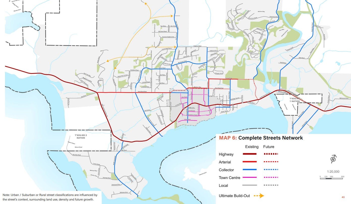
This map from the Transportation Master Plan shows Sooke’s planned “Complete Streets” network, identifying the location of existing and future highways, arterials, collectors, and local roads. The Throup Road Connector–Phillips Road Corridor is part of the arterial network (bright red arterial connection) and will eventually connect with other routes to form a continuous multimodal link parallel to Highway 14, improving traffic flow and travel options across the community.